There are a few places that the City of Calgary keeps updated to provide a visual map for the Land Use Bylaw - i.e. which properties are zoned for what.
Happy map spelunking!
The DMAP / Development Map
https://developmentmap.calgary.ca/
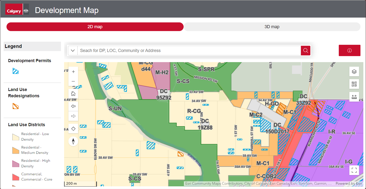
Pros
- Recently updated, very snappy
- Designed for rezoning / development research
- Layers, filters, and alternate basemaps
Cons
- Zoning layer not enabled by default
MyProperty
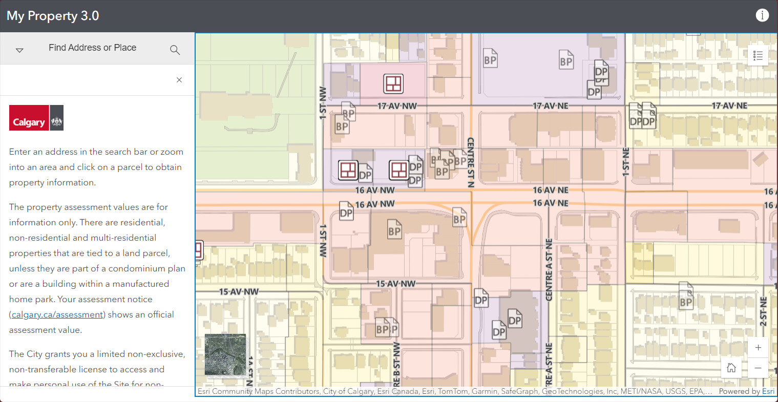
Pros
- Shows parcel lines
- Shows property valuation
- Layer automatically enabled
- Easy parcel search
Cons
- Must zoom far enough in
- Some data might not be relevant to you
Open Data Portal
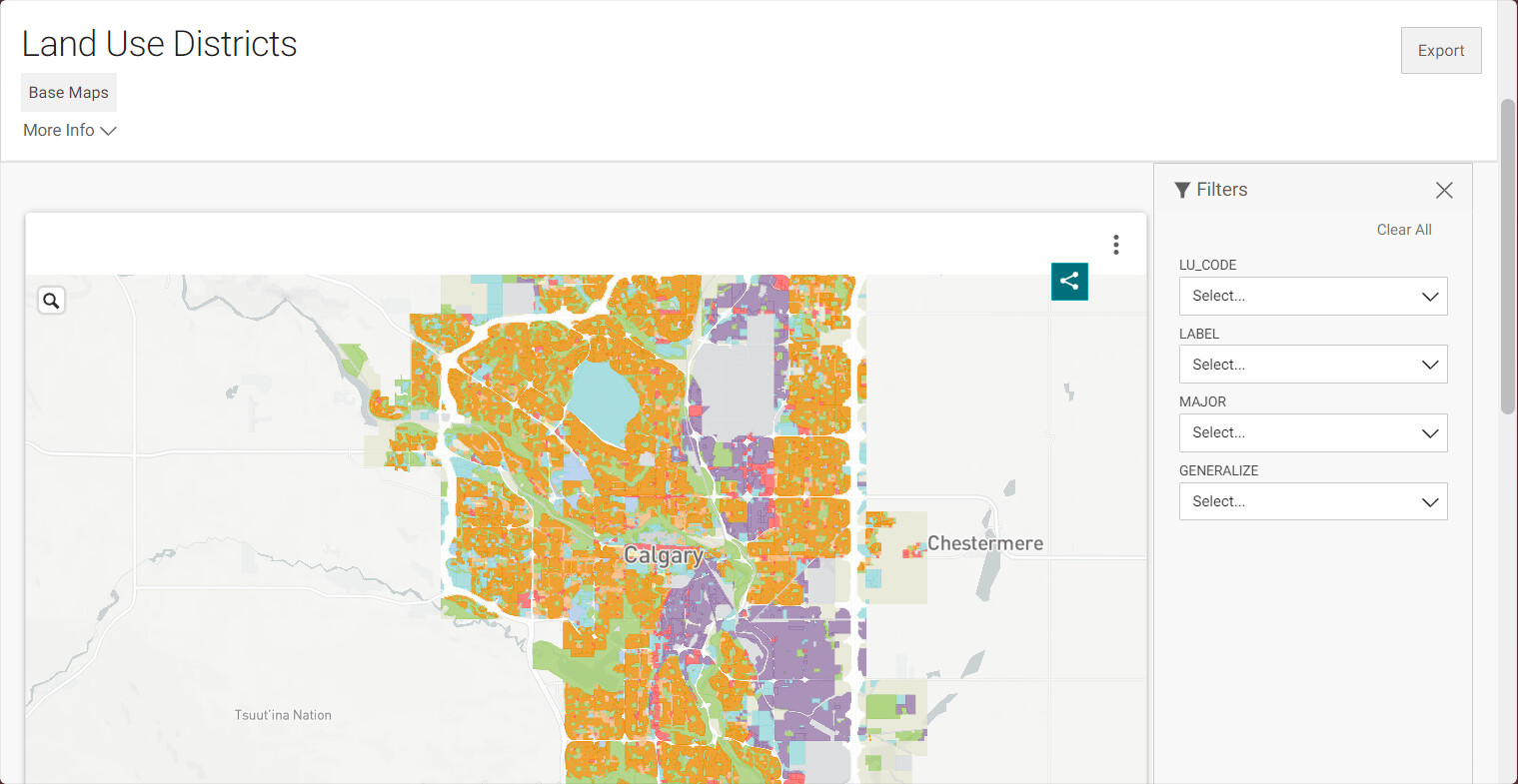
Pros
- Downloadable
- Can zoom out as far as you want
- Can filter by zone with the sidebar
Cons
- Data is by ‘chunk’ not by parcel